Helping clients continuously innovate to sharpen communications, protect our planet, expand scientific knowledge and advance healthcare
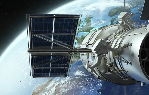
Our space journey begins in the 1970s when the first space station launched into orbit and the world was beginning to embrace its possibilities.
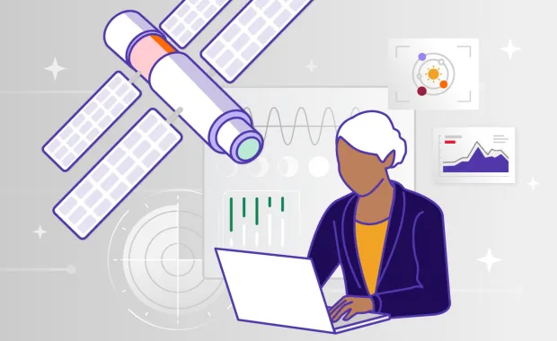
Since then, and for more than five decades, our clients around the globe put their trust in us to deliver spacecraft-operations software, ground-control capabilities and mission-critical infrastructure. Their vision shapes our work, and their challenges spur us to keep innovating across Europe, Australia, Asia and North America.
Powering Europe’s leap into space
One of our longest collaborations began in 1970 with the European Space Research Organization (ESRO), the precursor to today’s European Space Agency (ESA), supporting satellite navigation and expanding into mission control by 1974.
For more than 35 years, we’ve been working with the ESA and European Space Operations Centre (ESOC) in spacecraft operations and ground control systems, applying cloud, networking and knowledge-management technologies to optimize their mission performance.
Since 2003, we’ve also been a leading provider of end-to-end security systems for Galileo's constellation of 28 satellites—the European Union’s global navigation satellite system. From search-and-rescue missions to everyday smartphone positioning, we support its planning, implementation and deployment.
Transforming Earth observation into climate insights
As climate impacts came into focus, our collaborations provided data to help guide accurate weather and disaster responses.
Delivering critical imagery for severe weather detection, forecasting and climate monitoring, we supported the ground infrastructure for the European Organisation for the Exploitation of Meteorological Satellites (EUMETSAT) Meteosat's orbit missions.
We were also a part of the ESA’s ERS-1 and ERS-2 missions, providing critical data on oceans, land and polar caps and improving the ability to track floods and earthquakes worldwide.
Today, our expertise continues to evolve. We are collaborating with the Finnish Meteorological Institute on an ESA-funded initiative to strengthen the reliability of Arctic satellite measurements. As part of this project, we will develop an AI-supported information system for FMI’s Sodankylä Supersite, a world-leading center for environmental monitoring and climate research. This solution will help scientists process large volumes of satellite data more efficiently and securely by improving access to traceable reference data used to calibrate and validate satellite instruments.
Advancing worldwide scientific discovery
Partnering with leading space agencies, we help turn scientific questions into advanced exploration and insights across the solar system. Some of these include:
- Successfully pinpointing more than 100,000 stars with the ESA’s Hipparcos mission. It was the first to map the positions of the stars. We supported the effort by building the mission simulator, supplying ground-control systems and contributing to its onboard software.
- In the 1990s, we helped prepare the Cassini–Huygens probe for liftoff by designing all of the onboard software it would rely on during its seven-year journey to Titan, one of Saturn's moons.
- For XMM-Newton, then Europe’s largest scientific satellite, we supplied its payload-monitoring and mission control software.
- More recently, searching for clues that Mars may have once, and perhaps still could, support life, our systems enabled the next generation of deep-space exploration with the ExoMars mission. By delivering autonomous navigation and AI systems, we helped the rover orient itself and travel independently across greater distances.
Bringing connectivity and advanced healthcare to remote places
Whether connecting communities worldwide or supporting health in hard-to-reach places, our collaborations focus on turning innovation into impact.
Together with Eutelsat OneWeb, we designed and host the central resource management software enabling 650 of their low Earth orbit satellites to perform eight billion calculations every day. The system keeps satellites and ground stations in perfect formation and provides fast, low-latency connectivity across the planet—on land, at sea and in the air.
Additionally, we supported the European Commission’s UN:IO project, which aims to launch 400 laser-linked communication satellites to create a secure, sovereign and fast European communications network. Our role includes developing an innovative, automated concept of operations, defining comprehensive cybersecurity requirements for its ground stations and systems, and designing security scenarios that allow private and government institutions to use the network concurrently.
On the medical front, bringing AI-driven, integrated care to remote space missions and Earth’s most isolated locations, the Canadian Space Agency partnered with us to help build the Harmony Medical Module. In the absence of medical professionals, the module is equipped with tools and training to support remote detection, diagnosis, treatment, and monitoring of certain health conditions.
A shared journey toward new horizons

Our clients’ goals steer our innovation and strengthen the solutions we deliver. As we gaze up at the sky and help our clients anticipate what's next, we’ll continue advancing the systems, technologies and insights that power exploration, protect our planet and connect people—on Earth and beyond.