To play this video, enable Statistics cookies. Google/YouTube may process your data – Learn more.
Industrialize your application
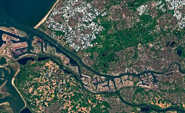
Imagine pairs of satellites working in teams to provide observations, each covering hundreds of square kilometers every few days. Now imagine constellations of dozens of small satellites, also working in teams to provide additional observations every day. Imagine a sophisticated range of camera technologies mounted on these satellites providing a diverse mix of observations, of relevance to a wide mix of monitoring requirements. Our ability to observe the Earth has transformed in the past few years but presents a challenge to organizations that want to make the most of it.


CGI GeoData360 solves common technical challenges for those aiming to exploit these new opportunities.
Reliable monitoring solutions that can run efficiently at scale require substantial processing resources and more sophisticated data processing capabilities which can be complex and costly.
CGI GeoData360 is CGI’s production platform for Earth observation (EO) and geospatial (Geo) services. The solution is designed for long-running, large-scale production pipelines as a platform-as-a-service. It supports deep customization and extension, enabling production workflows that consume EO and Geo data (to produce valuable business information) to run cost efficiently at scale.
Our platform can also host AI workflows. See how we use AI to remotely detect sewage overspill events from space.
Scalable
dynamic, optimized use of infrastructure resources available from commercial cloud providers. Reduces elapsed processing times.
Portable
deployable locally and within different cloud environments (both public and private) enabling the organization to control their infrastructure.
Operational
designed for production enabling reliable, consistent performance for commercially viable services with extensive monitoring and control capabilities.
Geospatial
big data production capabilities applicable to services based on imagery and/or other geospatial data (climate data, meteorological data, points, lines, polygons etc.).
Secure
designed to run securely in cloud infrastructures.
Cost effective
accelerates development of industrialized applications using a reliable workflow library, optimizing resource usage.
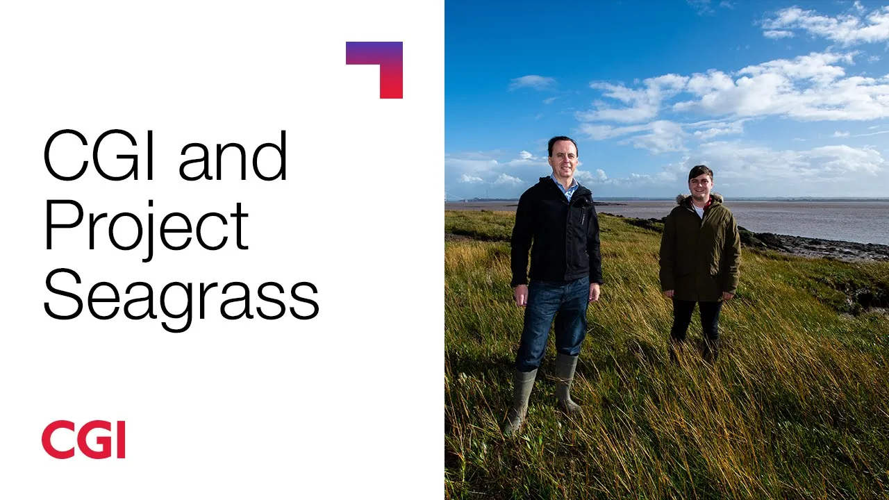
CGI and Project Seagrass
We are supporting the advancement, understanding and future conservation of seagrass through our collaboration with the charity Project Seagrass.
Through our CGI GeoData360 Earth observation platform we’re working with the charity to identify seagrass meadows from space.


Related media
Article
Snowflake Summit 2026: Why business context is becoming AI's competitive advantage
Article
AI-to-ROI progress depends on expanding talent and execution capacity

Blog
Cybersecurity defense at the speed of frontier AI: The new test of operational resilience

Article