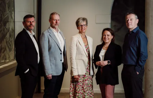
CGI (NYSE: GIB) (TSX: GIB.A), a leading global IT and business consulting services firm, in partnership with Ordnance Survey, has developed an initiative designed to remotely detect sewage overspill events from space. The project will utilise a newly created artificial intelligence (AI) model that can predict with high levels of accuracy the conditions most often associated with pollution events.
This is the latest project undertaken by CGI’s Sustainability Exploration Environmental Data Science (SEEDS) programme, a research initiative designed to challenge the thinking and practice around sustainability in partnership with academia, launched with the United Nations last year. SEEDS operates across multiple sectors, and nations, addressing multiple challenges with several partners.
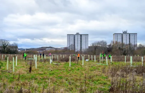
After an initial first phase, the project will provide a proactive approach to environmental management and nature protection in the North Devon UNESCO Biosphere reserve. The biosphere covers 55 square miles and is centred on Braunton Burrows, the largest sand dune system in England.
Andrew Bell, Chief Executive Officer, North Devon Biosphere said, "Here in the UNESCO biosphere reserve, we are keen to push the boundaries of the application of science to improve sustainability of the environment and the links between people and nature. The collaboration with SEEDS is a great opportunity to take our work in digital twinning in a catchment and test its enhancement with remote sensing for water pollutants."
Mattie Yeta, Chief Sustainability Officer for CGI in the UK said, “Following a successful first phase of the project, which led to the creation of an AI and satellite tool that can predict pollution events with up to 91.5% accuracy, we are excited to launch this second phase, which provides an innovative and proactive approach to environmental management and nature protection.”
By bringing together multiple sources of data, including data from sensors, the new solution will identify where and when pollution incidents take place, or where they may occur in the future. Using available data from the UK Environment Agency combined with data from CGI, Ordnance Survey, North Devon Biosphere and OpenSource satellite data, the project will use AI to map out where these incidents of pollution have taken place over a time period using CGI’s GeoData360 platform.
“The solution will benefit farmers, governments, water companies and other stakeholders by protecting our water from pollution and contamination, which is vital for both our way of life and the life of our waterways and coast lines,” continued Yeta. “At CGI, we are committed to providing insights our clients can act on, and with our partners through SEEDS, to bringing our insights and experience to projects such as this where we can really make a difference to our environment and the planet.”
Donna Lyndsay, Strategic Market Lead, Environment & Sustainability OS commented, “With the innovative technical ability that both CGI and OS have in abundance, we believe we may be able to help provide actionable insights for addressing water pollution events. We are looking forward to testing the AI models produced in our previous phase to see how they perform in the real world. We want to see if our work can be really used to support the Biosphere needs in identifying interventions to help preserve and restore our valuable habitats. If successful this has the potential to support remote monitoring of UK waterways for signs of pollution using data that is objective, regularly updated, and scalable.”
Longer term, the partners within CGI’s SEEDS programme plan for this tool to be replicated and rolled out at scale to reduce the impact of raw sewage pollution globally and to protect and enhance nature in the communities in those areas.
About CGI
Founded in 1976, CGI is among the largest independent IT and business consulting services firms in the world. With 90,250 consultants and professionals across the globe, CGI delivers an end-to-end portfolio of capabilities, from strategic IT and business consulting to systems integration, managed IT and business process services and intellectual property solutions. CGI works with clients through a local relationship model complemented by a global delivery network that helps clients digitally transform their organisations and accelerate results. CGI Fiscal 2022 reported revenue is $12.87 billion and CGI shares are listed on the TSX (GIB.A) and the NYSE (GIB). Learn more at cgi.com.
About Ordnance Survey
Ordnance Survey is a world-leading geospatial organisation and location partner. We deliver huge value to the UK economy and public sector through the Public Sector Geospatial Agreement (PGSA), and we keep Britain at the forefront of connectivity and innovation. We do this by providing location data and consultancy for evidence-based decisions in the UK and internationally, so our customers can deliver efficient services and the critical infrastructure for a sustainable future. Our OS Data Hub and simplified OS Select+Build service helps organisations stay one step ahead with the most comprehensive geographic data in Great Britain including our flagship APIs OS MasterMaps, OS Maps API and AddressBase.
For more information:
Media
Paul Butler
External Communications Manager
p.butler@cgi.com
+44 (0)7920 784199