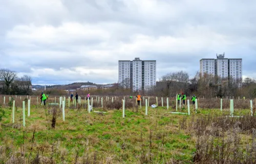
CGI supported the launch of the first section of the National Forest for Wales trail known as Llwybr Coedwig Cymru, at Porthkerry Country Park, marking an important milestone in delivering the programme’s long-term vision.
The launch event, attended by Wales’ Deputy First Minister Huw Irranca-Davies, represents a significant step in creating a connected network of woodland across Wales that enhances biodiversity, supports recreation and strengthens connections between people and nature.
Working in collaboration with the Welsh Government, CGI applied geospatial analysis and DataMapWales to help design and shape the trail route. By combining mapping expertise with data-driven insight, CGI supported the identification of a route that links landscapes, communities and existing woodland sites.
This work demonstrates how digital capabilities can translate national environmental ambitions into practical, real-world outcomes. Through geospatial technology, complex environmental and spatial data was transformed into an accessible and deliverable trail that people can experience on the ground.
The new trail will enable residents and visitors to explore more of Wales’ natural environment while contributing to the wider goals of the National Forest for Wales programme. It also highlights the role of data and technology in supporting public sector initiatives that deliver environmental and social value benefits.
CGI continues to work with public sector organisations across the UK to harness data, digital tools and geospatial insight to support sustainable development and long-term environmental goals.
Learn more about CGI’s geospatial expertise and how we support public sector organisations in delivering environmental outcomes.