Lees hier de Nederlandse versie
How great is it to be able to combine work with helping to excavate a 3500-year-old grave in Egypt by creating high-quality digital 3D models of it. This opportunity arose from a hobby of Robert Voûte, who had previously taught modern surveying techniques to archaeologists in Egypt. After learning to read the ancient Egyptian language (also known as hieroglyphs), he came into contact with an international group of people with high positions in Egyptology. Egyptology is a combination of knowledge of the history of ancient Egypt, the language and the art. Robert was asked to use his knowledge of geodesy to help increase knowledge of surveying of people who work on archeological excavations in Egypt. For Robert, this was a part of his guest professorship at TU Delft (Geomatics and Geoscience and Remote Sensing). This resulted in a request from the University of Leiden to do this at the excavation of the so-called grave TT-45 on the west bank of the Nile, in the area of Luxor. The request was to make a very accurate 3D computer model of this underground tomb and to capture everything well so that studying this grave would also be possible without traveling to Egypt.
Robert asked two colleagues to join him on the project and help with their knowledge of photogrammetry (3D photography) and GNSS (GPS) positioning. In this project, the starting point was always to do complete the project with the most simple tools and to keep the learning curve as short as possible. Above all, the goal was to complete the project with the lowest financial resources so that the tools and techniques used would be accessible to excavation teams with limited budgets.
To determine if the intended techniques would work well, Robert, Hessel and Bart-Peter practiced extensively in the Netherlands. First, the team made a high-quality digital 3D model of the Taffeh Temple in close collaboration with the National Museum of Antiquities in Leiden. The temple is located in the reception hall of this museum, and was given by the Egyptian authorities in gratitude for the Netherlands’ part of saving Nubian monuments near Abu Simbel when the High Dam was built in the Nile. The team also built a GNSS setup that could be used in the field to measure points in X, Y, and Z with a very high accuracy.
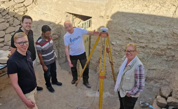
The team was sponsored by CGI in the form of Corporate Social Responsibility days, allowing the team to stay longer in Egypt. The adventure began with two weeks in Luxor for the measurement of the grave and its immediate surroundings, all in 3D. The Egyptian climate posed quite some challenges to the project, but in the end the team was able to achieve their goal of creating a very accurate 3D model of the grave and its surroundings.
It was a bit of an adjustment to get used to the wonderful temperatures there (about 28 degrees during the day), but after that they were able to get to work quickly. Photos were taken every day, both underground and at the entrance to the grave. In total, about 4000 photos were taken with a system camera that is readily available, of which about 2700 photos were used in the final computer model. In addition, a modern smartphone with a LIDAR (laser scanner) option was used to create 3D models. All of this was scaled with a homemade wooden measuring stick that was placed on the ground in the grave and, of course, by accurately measuring a number of points (about 1 cm precise) in GPS coordinates in the immediate vicinity of the grave. Every day, a lot of work was also done on computers to process all the data into final products. Sometimes this resulted in having to retake some of the photos to get a very accurate model. The GNSS setup was also used every day to measure one point, which was a time-consuming task due to the recording time of 12 hours per point to get an accurate measurement.
The results are so good that during the first two weeks, beautiful results could already be delivered to the excavation team led by Dr. Carina van den Hoven. The excavation team could clearly see how the underground part relates to the environment in the open air. Making further excavations more convenient.
In the free time and on the last days, of course, enough time was also spent to visit the most beautiful antiquities of ancient Egypt. With Robert as a guide, that was extra entertaining.
Meanwhile, almost all of the results have been completed, the preliminary results have been delivered, and this team has been asked to come back next year to measure again. A whole new piece will have been excavated by then; this work remains of great importance. And fun!
Over deze auteurs
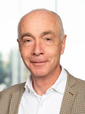
Robert Voûte
Vice President Consulting Geo-ICT
Robert Voûte is verantwoordelijk voor de koers en visie van CGI in Nederland op het gebied van geografische informatie, 3D (modelling), plaatsbepaling (binnen en buiten) en operationele beelden (COP’s) met als specifiek aandachtsgebied vitale civiele infrastructuren en de daarbij behorende digital twins. Als ‘Geodeet’ ...
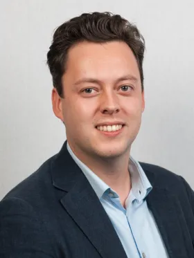
Hessel Prins
Software Engineer GEO-ICT
Hessel is als software-engineer sinds eind 2020 werkzaam bij CGI, waar hij na zijn afstuderen bij de Rail-Infrastructure unit nu werkzaam is bij de Infrastructure unit. Als leergierige Geo-ICTer is hij altijd geïnteresseerd in nieuwe ontwikkelingen op het gebied van plaatsbepaling, laserscanning en fotogrammetrie met ...
Bart-Peter Smit
GEO-ICT consultant
Bart-Peter is een enthousiaste en nieuwsgierige Geo-ICTer, die zijn kennis graag inzet bij innovatieve projecten. Zijn interesse in onder andere Situation Awareness, 3D scanning, Human Factors, Data Governance en Datagedreven Werken komt daarbij goed van pas.