Enhancing urban and regional transportation by enabling autonomous aircraft to take off, navigate, and land in complex environments at aviation levels of safety using automotive sensors. Aircraft operations in urban areas must increase beyond current capacity if the economic growth potential resulting from an advanced air mobility (AAM) infrastructure is to be realised. This requires precision navigation in dense traffic in complex environments, such as inner cities, which are difficult to predict. This makes automated systems key enablers of AAM-driven economic growth.
To create an autonomous flight control system for safe operations in such complex, urban environments, CGI and Continental Engineering Services (CES) studied the feasibility of a situationally aware, hybrid navigation solution. The system is based on ASIL (Automotive Safety Integrity Level)-compliant automotive sensor technology, which are integrated with other sensors, passive ranging of 5G networks and GNSS (Global Navigation Satellite System) receivers.
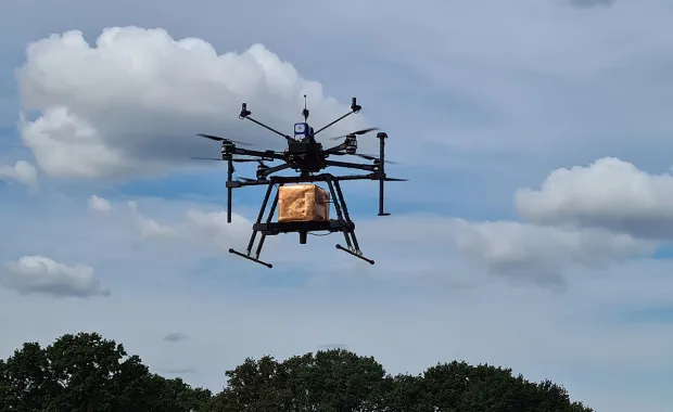
We designed algorithms to determine the position of a drone with associated confidence levels for a combined GNSS/5G system. Real-world trials were based on flights of a drone equipped with 5G and GNSS antennas and a self-contained bespoke GNSS and 5G data capture payload, shown here. The trials confirmed the feasibility of the hybrid approach, as well as giving insights into 5G visibility at altitude.
Together with CES we have laid out a roadmap for development starting with the current data capture and assessment phase and followed by a series of Minimum Viable Products (MVPs).
Read the full factsheet by downloading it, or refer to our white paper, Enabling Autonomous Take-off and Landing in Urban Environments.