In this episode of our Energy Transition Talks podcast series, CGI space expert Harjit Sheera shares with Peter Warren how the volume of space data is not only ever-increasing, but also growing in impact and application across industries. Discussing how processing space data for accessibility and effective use was previously an arduous task, they explore how artificial intelligence (AI) and advanced processing platforms are helping organizations make the most of their space data. From environmental impact monitoring to emissions mapping and data layering, space data is changing the way we see and act on energy transition goals.
Improving and accelerating traditionally cumbersome space data with AI
Operating across the entire space stakeholder chain, CGI space experts work as advisors for space organizations, collaborate with regulatory agencies and support end users through application development and managed services.
In her almost 20 years of experience working in space, Harjit knows the legacy challenges space data poses, specifically in terms of harnessing and translating its vast volume. “It takes a lot of processing power, a lot of storage energy and a lot of standardization to make that data available to people who can turn it into something that the end user will see.”
Emerging processing engines (including those processing earth observation data, examining imagery or setting standardized requisite parameters) are using AI, machine learning and advanced algorithms to refine further and perform better, faster. This means greater volumes of data can be processed more efficiently and more, diverse user requirements can be addressed.
Specifically, AI helps identify key elements in satellite images and processes them faster, based on set user requirements. For example, Harjit shares the use case of farmers leveraging AI and satellite imagery data to monitor and demonstrate how they’re farming their land and what kind of crops they’re growing, to claim government subsidies.
Peter highlights the positive implications the advanced deep learning and crop recognition use case has for energy organizations who want to monitor, for example, leaks or the growth of vegetation under power lines and near utility company infrastructure. It all helps to reduce the cost of maintenance and potential damage.
As AI and satellite data become increasing critical to monitoring environmental changes over time, their accelerated frequency and efficiency at processing satellite images also allows more immediate mapping of real-time, dramatic developments. Pointing to the rapid mapping of landscapes impacted by major events such as war as an example of how space data processing has improved, Harjit explains, “Instead of having to wait maybe a week to see how a timeline has changed, you can see within a day, maybe even within the space of a few hours even. So that's really a nice development.”
Combining other data with space data creates robust analysis for environmental action
Moving beyond monitoring and mapping ongoing developments, AI and space data also help organizations predict future outcomes. Especially, according to Harjit, when you combine monitoring data from other sources that consider other variables to produce more robust insights and recommendations.
She shares three key examples:
- AI can help predict much more accurately the threat of wildfires using algorithms and additional data collated by governmental agencies on the likelihood of wildfires. Agencies can produce broad monthly predictions, but combining satellite-based intelligence and AI techniques to augment existing data enables more proactive protection services to be created.
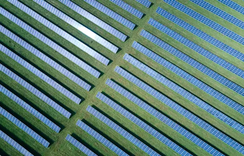
- When assessing the power-generating potential of buildings, additional data can help answer:
- Is it cost efficient to mount solar panels on this building (for a residential client) or even all our buildings (for a commercial operator like for example DHL)?
- Can we see this potential in built up areas as well as rural areas where perhaps you have a lot of buildings or where perhaps you may be able to mount solar power panels?
- Is there a way of generating energy that you can then feed back into the utility chain as well?
- The newly launched SpaceX satellite can now monitor the release of methane plumes across the Earth, especially from oil and gas companies, detecting areas that are producing more emissions than they should be. So not only is it from the atmosphere, but also straight away from looking at images of the Earth as well.
While the use cases for space data are endless, Harjit says the winning formula lies in not relying on space data alone. By combining space data with other forms of data, they can augment each other, providing more information to the professionals who examine and assess it. They can then factor this into their prediction, formulate their algorithms and shape the way that they use the data.
Ultimately, Harjit says, “The added value that space data brings you is that global view on top of the local knowledge obtained from the data gathered on the ground.” This provides a clearer, bigger picture in terms of what the analysts can then see—and most importantly, in terms of what environmental action can be taken with that data-driven viewpoint.
Listen to other podcasts in this series to learn more about the energy transition
Read the transcript:
- 1. Introduction and CGI space pedigree
-
Peter Warren:
Hello, everyone. Welcome to another installment on our continuing journey on data and how it interacts with the ever-changing ecosystem of energy and utilities. We have a really good opportunity today to have another conversation on how space data applies to this, and space data has been a key part of the energy and utilities marketplace for quite some time. And today my guest, Harjit Sheera, is an expert in this and leads our space practice. So Harjit, do you want to give yourself a quick intro and tell everybody about you?
Harjit Sheera:
Yeah. Hi, Peter. Thanks for inviting me today. Yeah, I've been working in our space unit for almost 19 years now, I think it has been. Started off with working in UK SDI, where I started off in the satellite navigation domain, where we also crossed with Earth observation and satellite communications. And then I progressed as a program manager and now I work for the global space community where I'm the current representative for our global space industry across all of our business units here. So yeah, thanks again for inviting me. A pleasure to talk to you all today.
Peter Warren:
Oh, you're welcome. And that's brilliant. And it gets into the pedigree of CGI. We're not just a consumer of space data, you were talking about running satellites and things. What is our pedigree in space?
Harjit Sheera:
Yeah, we have a great pedigree here in space because not only do we operate across the whole of the stakeholder chain, we also work as advisories to a lot of the space organizations as well. And we're also involved in a lot of the regulation side of things as well. So working with companies like ISSA who launched the satellites, who gather data, all the way through to creating, processing engines ourself, and then also working with our users as well to look at how we can create applications for them, how we can support them in their services. So yeah, we work along the whole chain. I think this is our defining point for our space business.
- 2. Space data requires robust processing to enable accessibility and usability
-
Peter Warren:
That's got to give you a unique perspective then when you not only help launch satellites, fly them, but you're actually pulling the data from it. How do you see platforms benefiting all that? I mean, we've developed some, there's some in the industry. How do you see all of that coming together because it's very distinctive task from launching a satellite to using the data? How do you see all that sort of mixing together?
Harjit Sheera:
Yeah, so although we're not really involved in the launch side of things, yes we've written software that goes onto the satellites to help them to either process information or to send information backwards and forwards. I guess to start off with is the space data is always going to be increasing and we've seen the trend, we know it's going to continue, especially with the introduction of commercial companies who are also providing satellite data and gathering that as well. So historically, there's always been an issue with the way that the amount of space data there is and how we make that space data usable. It takes a lot of processing power, it takes a lot of storage energy, it takes a lot of standardization in order to make that data available to people who can actually turn it into something that the end user will see.
So the big thing that's happening at the moment is the concentration of the way that the data is processed and there's processing platforms that have been created for this and those processing platforms are trying to standardize the way that this data is, the way it's processed and also the way that it's provided to our users. So that's really the role that these processing engines do, and the better that these engines are, the better that they're able to process the volume of data that they have and then also make that data usable to those end users. There's various types of engines. Some of them deal with looking at images, some of them look at actually standardizing the parameters that you can select for the requirements for each of those data. But those engines are getting better and they're getting faster and the algorithms that are being used can also be refined more. So it's increasing the amount of data that can be processed, but also addressing a wider range of requirements that people are now requesting.
- 3. The growing importance of AI in processing space data
-
Peter Warren:
That's brilliant. I mean, the commercialization of space from tourism and every other format of it has certainly taken place. So we've gone from the journey, I guess, of dealing with national companies, organizations flying this military wise into this commercialization area. With commercialization, I guess it kind of parallels the evolution of AI coming into this and looking at it data coming forward, as you mentioned about the platforms and optimizing it. But what's the new things with AI? How would that apply to somebody like a utility?
Harjit Sheera:
Yeah, so again, it's mainly around the processing of this information. So if you're looking at something for example, which is maybe viewing images of the Earth, it'll be things like machine learning in terms of recognizing what the user needs to recognize from each of those images and to process those images faster. So that kind of AI technology on top of the algorithms and the processing power that we have, that's what's really making the big changes. And also there's also deep learning that's going on as well with a lot of these processing engines as well, but also the applications that we're using also. So those are the way that the AI is helping, the way that the data is processed and the way that it's being, or the images that you get from satellite data are being used to explore more requirements and things like crop recognition from satellites.
So where you are looking at farmers having to monitor how they're either farming their land or how regularly they're farming their land and what kinds of crops they're growing. There's applications and use cases out there where satellite images are being used to track all of this kind of information so that people can get their subsidies in from the governmental agencies and that farmers are able to claim for these subsidies. And the process of completing that chain of events is also quicker response. So that's certainly helping people do processes like that.
- 4. Opportunities and parameters of satellite data for environmental use cases
-
Peter Warren:
I know when we talked to Diane Gutiw about AI, she said it always starts with the use case, what are you trying to solve? And you mentioned about the crops, but I know you've also done environmental work. You've looked at environmental situations for energy companies, looked for leaks, looked even at forestry aspects. What kind of trees are growing underneath power lines and near utilities? So this advanced deep learning that you're talking about, that seems to be accelerating very quickly. Are you having any surprises in these kind of projects when you work on them or some aha moments?
Harjit Sheera:
I think really quite often it's the requirements that we're getting those surprises in where we're talking to our clients and a lot of them don't really understand the extent to which the satellite data can be used. So a lot of it is managing people's expectations. So first of all, we want other industries and users of the satellite data to understand that just by using satellite data is not going to answer all of your requirements. There's going to be a use case where you need to understand what the satellite data can do and then what it can do for your industry or for that particular use case. So yeah, we do think there are cases where you can monitor not just trees, but also the specific kind of crops and the speed at which these crops are growing and how far they are infiltrating the infrastructure so that they're not preventing services to users, but also things like mapping of wildfire burnt areas as well.
So that's also quite topical at the moment where we've seen in the news recently where there's been lots of wildfires that have to season perhaps or more vigorous than they would've normally have been or have been in the past. And to try and monitor how this is changing over time is also something that's quite prevalent. But also things like when we've had some major events that change the agriculture scape of lands as well, that's also quite an interesting concept where being able to map how the environment or the landscape is changing because of the frequency and the efficiency at which we're able to process these images. It shows us in a very short space of time how landscapes have changed and you can process that very, very quickly. So instead of having to wait maybe a week to see how a timeline has changed, you can actually see within a day, maybe even within the space of a few hours even. So that's really quite a nice development.
- 5. Using AI to assess and predict performance and emissions across industries
-
Peter Warren:
It's those improvements in image quality processing again where AI comes into to look things. Of course, it's happening in the healthcare industry, checking for scans. But the same thing applies here. I know when we were talking too, is that even looking at Ukraine, the landscape, what's happened there, what's happening to their agriculture, the energy industry in Ukraine is a key part of what Europe needs for energy with the large nuclear plant and things. So you're able to actually look at those things and see how they've evolved over time. And does that also then get into the prediction of what it might look like in the future as well?
Harjit Sheera:
Yeah, definitely. You can use AI to see what would happen if this were to continue, if the land were to degrade. But then if you're using other data as well on top of that, in terms of, so for example, if you're taking Ukraine into account, a lot of the grain that they produce there feeds into the overall food supply chain. Taking into account those factors as well, you're going to need to understand where an alternative supply chain could be found. And then also perhaps even monitoring of crops. Can we grow these crops in other areas of the landscape? So perhaps if there's one area that's being affected more than others, is there potential to move this kind of crop growth to another area? And then there's also things like the provision of energy as well. So if a lot of the infrastructure is being impacted, is there a way that this infrastructure can be built up in another area?
So for example, just looking at the way that power sometimes is generated where you can assess the power generation of buildings. So is this something that can be assessed in a different way? Can we see this perhaps in built up areas where perhaps buildings where you have a lot of buildings that where perhaps you may be able to mount solar power panels and is there a way of generating energy that you can then feed back into the utility chain as well? And then there's also areas such as monitoring of emissions as well. So I don't know if a lot of you have seen the news today and that you've seen the launch of the SpaceX satellite, which is now going to monitor the release of methane plumes across the Earth, especially from oil and gas companies.
So this is something that they're looking at the moment, and this is to try and detect those areas that are producing more emissions than they should be. So not only is it from the atmosphere, but also straight away from looking at images of the Earth as well. So that's something else that is quite prevalent as well at the moment.
- 6. Combining different types of data creates robust, actionable insights to act on
-
Peter Warren:
The connection between using space data for environmental things in the energy industry is a key. Methane of course is a worse greenhouse than CO2, plus it's leaking out of abandoned wells all over the planet. Here in Canada we have a problem with that. So being able to pinpoint those and look at it. Methane used to be also looked at as a dead end, meaning that if we cap this well that we're only doing that to be nice, but there's actually an opportunity for people to produce the hydrogen or other products that are this. So the economic connection between space data and energies there. The other one is with the droughts that have been going on. In British Columbia last year, they were concerned about smaller hydroelectric dams, but that's not just in Canada, it's around the world. So looking at the environmental aspect, do I have enough headwater moving forward with even glaciers melting? You're able to do a lot of prediction and models that actually directly impact things like hydroelectric power.
Harjit Sheera:
Yeah, absolutely. So monitoring the weather is something that is also a large part of what we do here at CGI as well. So we're involved with a lot of agencies that look at monitoring, whether there's applications and use cases that will monitor things like the prediction of storms, maybe even trying to amalgamate seismic data as well with space data as well. So looking at how perhaps these space data can impact the changes in the environment and potentially predicting when there's going to be some kind of seismic activity or some sort of volcanic activity that may also impact what's happening.
So yeah, the uses are really endless and it's just really looking at how closely we can monitor these changes, but also not just using the space data alone. By combining it with the other forms of data that we have, you're actually finding that you are augmenting one on top of the other, which is giving more information to the professionals that are looking at this and information and assessing the information. They're able to then put this into their prediction, formulate their algorithms, the way that they use the data as well. So on top of everything else, I think the added value that the space data is bringing is it brings you that global view on top of the local knowledge that you get from the data that you're gathering on the ground. And then this is providing a clearer and a bigger picture in terms of what the analysts can then see.
Peter Warren:
I think that's a great way to wrap this up. It's the combination of space data with other data, other systems and using it to optimize each other and really looking at it as the whole, both on the macro and the micro levels.
- 7. Concluding thoughts on the wider applications of space data
-
Peter Warren:
Thank you very much for that. Any final thoughts as we close out here?
Harjit Sheera:
Yeah, absolutely. So quite often we've been talking about space data and how the space community are using this, but what we are really trying to emphasize here to everyone is that the space data can be used in all of these industries and we have so much data now. It's actually the use cases that need to catch up to the use of the potential of the space data that we have. So it's how can we maximize the use of this space data, not just for the space industry, but for all those wider industries and how else can we use this data to really help us meet our requirements in all these areas.
Peter Warren:
Yeah, rail, manufacturing, shipping, all those industries can benefit from this. Well, thank you very much Harjit. Appreciate your time and expertise and we'll chat with you later. Bye-bye. Thanks everyone.
Harjit Sheera:
Thank you very much..